Your cart is currently empty!

OrthoPhoto
Orthorectify your aerial photos quickly and easily!
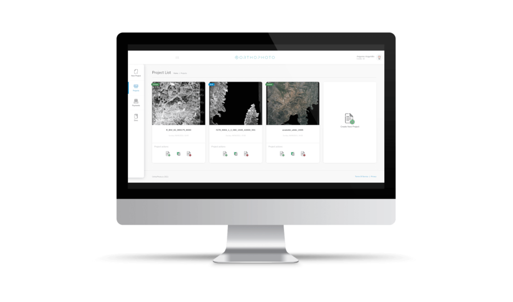
Orthorectify your aerial imagery in just 4 steps

Upload your aerial image

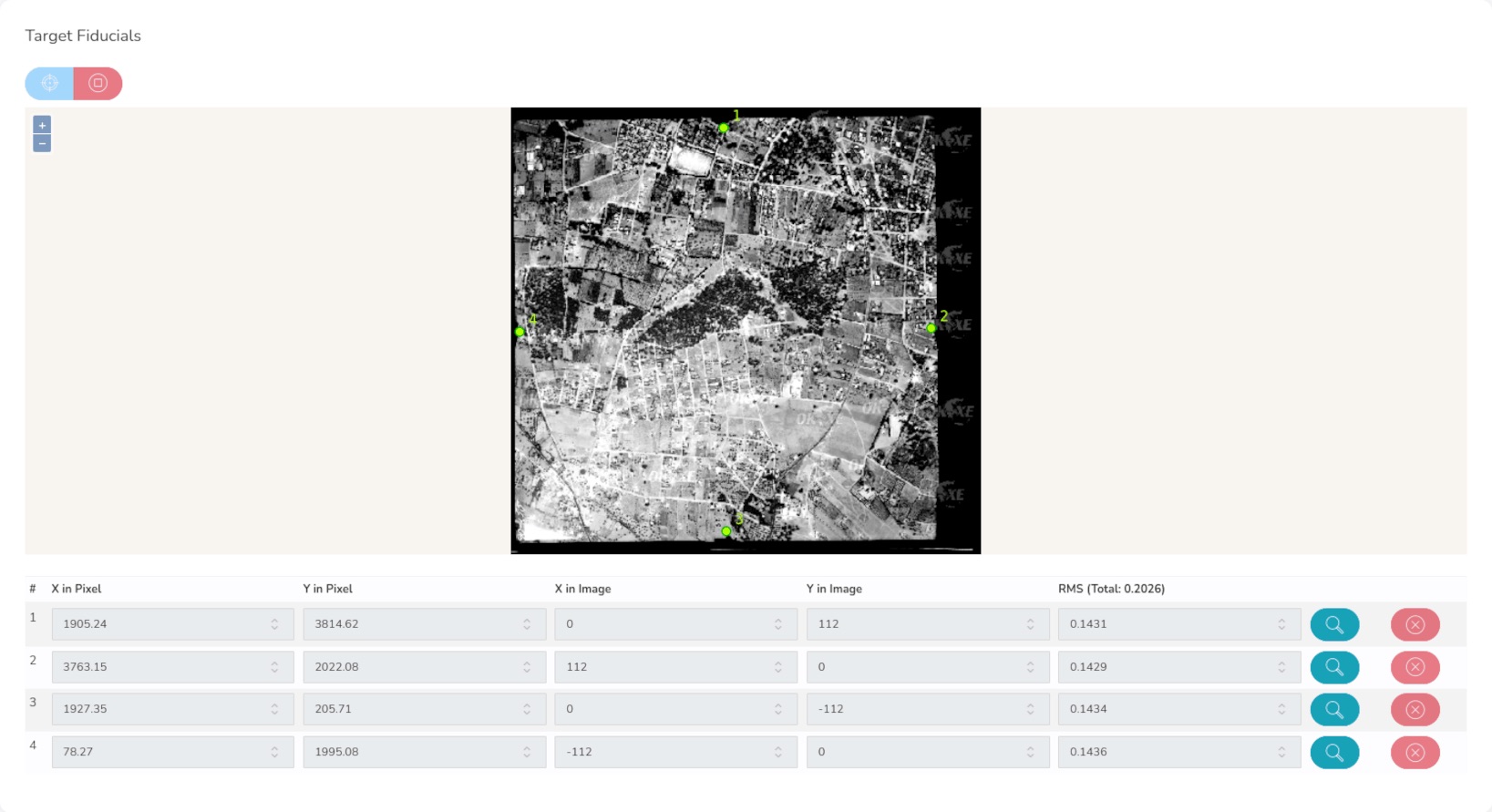
Target fiducial points

Identify Ground Control Points

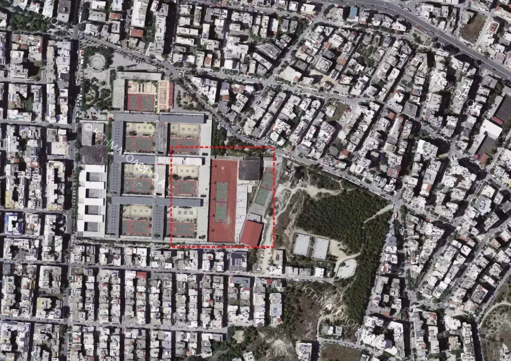
Download the orthophoto
Begin by uploading your aerial image directly from your device. Provide the internal parameters, and watch the magic unfold. If you have a Digital Elevation Model, fantastic! If not, our system takes care of it with an automatic selection. Precisely pinpoint fiducial points on our interactive online map, empowering the system to compute your internal camera reference system.
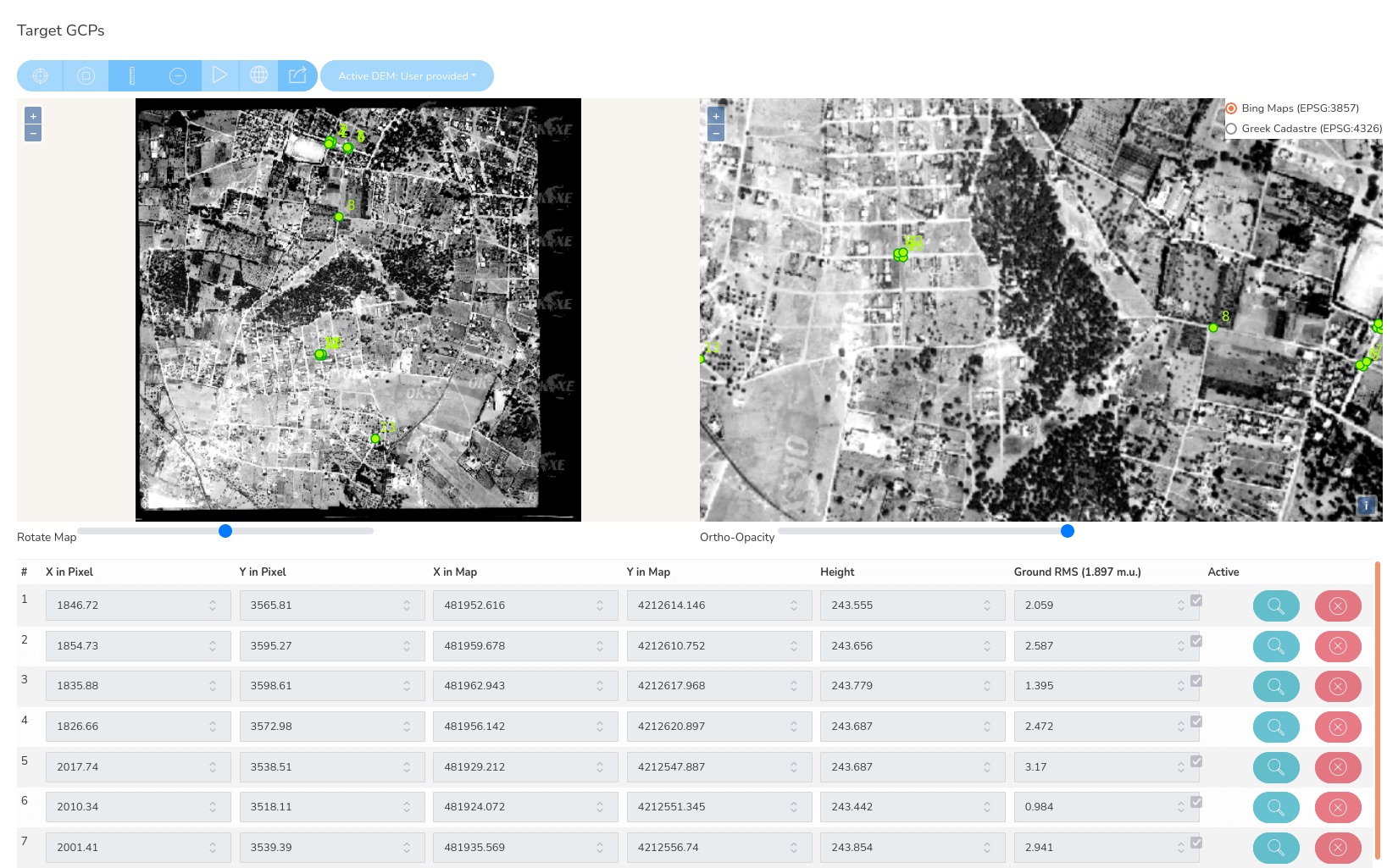
Improve your accuracy by locating strategic ground control points – either by targeting them manually or by typing them if you already have them. Then all you need to do is wait and OrthoPhoto.io will deliver to you the generated, ready-to-use orthoimagery!
Pricing plans
Explorer
- Orthorectification of 1 aerial image.
- Ideal for one-off or occasional users with specific project needs.
Navigator
- Orthorectification of 2 aerial images.
- Perfect for users with a couple of aerial shots or a small project.
Pro
- Orthorectification of 5 aerial images.
- It ensures efficient and precise support for your ongoing mapping processes.
Enterprise
- Tailored orthorectification services.
- Ideal for large-scale mapping projects.
- Contact us for a quote
Why choose OrthoPhoto.io
- Online tool, no installation required
- User-friendly and modern interface
- Digital Terrain Model included for any location in the globe
- High-detailed terrain models for specific countries (e.g. Greece)
- Easy integration in your webGIS applications and pipelines

Subscribe to our newsletter
We’ll send you news, offers, tutorials and many more!
The fastest way to orthorectify your aerial photos
© OrthoPhoto.io